Cart 0
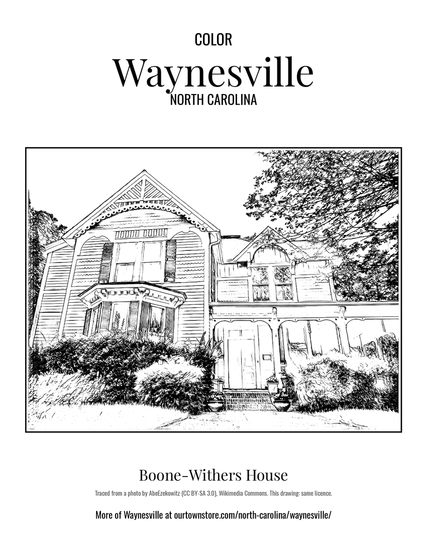
Boone-Withers House, Waynesville, North Carolina

WAYNESVILLE

North Carolina
Shop the collection

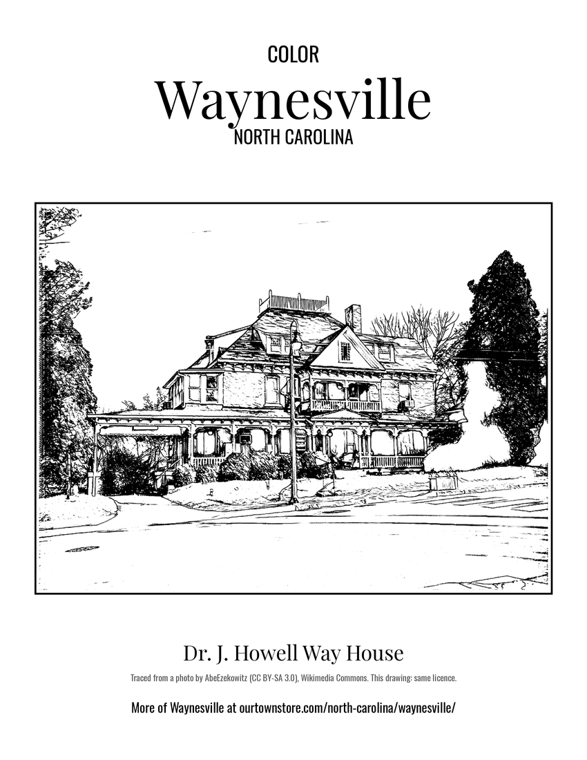
Waynesville is located about 30 miles southwest of Asheville between the Great Smoky and Blue Ridge Mountains. Landmarks include Boone-Withers House, Frank Smathers House and Dr. J. Howell Way House. Waynesville is the birthplace of Chuck Edwards, politician.

The Waynesville Collection

Made for Waynesville. Printed to order.

Waynesville, North Carolina gifts and souvenirs: 42 designs made from Waynesville's own map, landmarks and history, from $10 to $99. Printed to order and shipped free in the USA.

PopularPrice
Waynesville Hometown Ornament$23
Waynesville Landmarks Photo Posterfrom $40
Waynesville Vintage Travel Posterfrom $40
Waynesville Varsity Crewneckfrom $57
Waynesville Est. Teefrom $33
Waynesville Town Line Mugfrom $26
Waynesville Hometown Ornament

Waynesville Hometown Ornament

Ceramic keepsake, gold ribbon, in 4 styles

$23
Waynesville Landmarks Photo Poster

Waynesville Landmarks Photo Poster

Nine local landmarks, archival matte

from $40
Waynesville Vintage Travel Poster

Waynesville Vintage Travel Poster

Its landmark photo in a classic travel-poster layout

from $40
Waynesville Photo Art Print

Waynesville Photo Art Print

A local landmark photo as a gallery print

from $40
Waynesville “Greetings From” Poster

Waynesville “Greetings From” Poster

Classic large-letter postcard art, filled with local photos

from $40
Waynesville Snapshot Collage Poster

Waynesville Snapshot Collage Poster

Six local landmarks as instant photos on kraft paper

from $40
Waynesville History Timeline Poster

Waynesville History Timeline Poster

The town's story in dates, from its own records, for home or classroom

from $44
Waynesville Map Placemat

Waynesville Map Placemat

Map of local landmarks, washable fabric

$31
Waynesville Varsity Crewneck

Waynesville Varsity Crewneck

Heavy-blend fleece, street map printed on the back

from $57
Waynesville Hometown Knit Sweater

Waynesville Hometown Knit Sweater

Red heavy-blend crewneck, knit-stitch town print

from $57
Waynesville Est. Tee

Waynesville Est. Tee

Soft Bella+Canvas jersey

from $33
Waynesville Est. Youth Tee

Waynesville Est. Youth Tee

Kids' Bella+Canvas jersey, youth sizes

$30
Waynesville Est. Toddler Tee

Waynesville Est. Toddler Tee

Bella+Canvas toddler jersey

$29
Waynesville Est. Baby One Piece

Waynesville Est. Baby One Piece

Bella+Canvas baby bodysuit

$30
Waynesville “Greetings From” Tee

Waynesville “Greetings From” Tee

Large-letter postcard art filled with local photos

from $35
Waynesville Town Line Mug

Waynesville Town Line Mug

Glossy ceramic, dishwasher safe

from $26
Waynesville “Greetings From” Mug

Waynesville “Greetings From” Mug

Large-letter postcard art filled with local photos, 11 oz ceramic

from $29
Waynesville Garden Flag

Waynesville Garden Flag

Weatherproof, for the front walk

$31
Waynesville Welcome Doormat

Waynesville Welcome Doormat

24″×16″, printed coir-look fibers, rubber back

$66
Waynesville Hometown Wood Sign

Waynesville Hometown Wood Sign

12″×12″ printed wood, ready to hang

$48
Waynesville Map Throw Pillow

Waynesville Map Throw Pillow

Soft-touch, zip cover

$47
Waynesville Landmark Photo Pillow

Waynesville Landmark Photo Pillow

A local landmark photo with the town name, 18″×18″

$49
Waynesville Market Tote

Waynesville Market Tote

Sturdy all-over-print tote

$37
Waynesville “Greetings From” Tote

Waynesville “Greetings From” Tote

Large-letter postcard art on a sturdy tote

$37
Waynesville “Greetings From” Trucker Cap

Waynesville “Greetings From” Trucker Cap

Foam-front trucker, printed (not embroidered) with local photos

$33
Waynesville Cork Coaster

Waynesville Cork Coaster

Glossy top, cork back

$16
Waynesville Street Map Throw Blanket

Waynesville Street Map Throw Blanket

Soft fleece, 50″×60″

from $72
Waynesville Snapshot Collage Blanket

Waynesville Snapshot Collage Blanket

Six local landmarks as instant photos, soft fleece 50″×60″

from $76
Waynesville Est. Tumbler

Waynesville Est. Tumbler

20 oz, double-wall stainless

$51
Waynesville Boone-Withers House Postcard

Waynesville Boone-Withers House Postcard

6″×4″ postcard, glossy front

$10
Waynesville Frank Smathers House Postcard

Waynesville Frank Smathers House Postcard

6″×4″ postcard, glossy front

$10
Waynesville Dr. J. Howell Way House Postcard

Waynesville Dr. J. Howell Way House Postcard

6″×4″ postcard, glossy front

$10
Waynesville Waynesville Municipal Building Postcard

Waynesville Waynesville Municipal Building Postcard

6″×4″ postcard, glossy front

$10
Waynesville Haywood County Courthouse Postcard

Waynesville Haywood County Courthouse Postcard

6″×4″ postcard, glossy front

$10
Waynesville Masonic Hall Postcard

Waynesville Masonic Hall Postcard

6″×4″ postcard, glossy front

$10
Waynesville Sanborn Map Print

Waynesville Sanborn Map Print

The town's earliest Sanborn fire-insurance map, drawn building by building and hand-coloured, from the Library of Congress

from $44
Waynesville Oconaluftee Ranger Station, House, U.S. Highway 441 Archive Print

Waynesville Oconaluftee Ranger Station, House, U.S. Highway 441 Archive Print

From the Library of Congress collections: a historic survey drawing or photograph of the town

from $44
Waynesville Oconaluftee Ranger Station, Barn, U.S. Highway 441 Archive Print

Waynesville Oconaluftee Ranger Station, Barn, U.S. Highway 441 Archive Print

From the Library of Congress collections: a historic survey drawing or photograph of the town

from $44
Waynesville Oconaluftee Ranger Station, Corn Crib, U.S. Highway 441 Archive Print

Waynesville Oconaluftee Ranger Station, Corn Crib, U.S. Highway 441 Archive Print

From the Library of Congress collections: a historic survey drawing or photograph of the town

from $44
Waynesville Ocanaluftee Ranger Station, Chicken House, U.S. Highway 441 Archive Print

Waynesville Ocanaluftee Ranger Station, Chicken House, U.S. Highway 441 Archive Print

From the Library of Congress collections: a historic survey drawing or photograph of the town

from $44
Waynesville Oconaluftee Ranger Station, Blacksmith Shop, U.S. Highway 441 Archive Print

Waynesville Oconaluftee Ranger Station, Blacksmith Shop, U.S. Highway 441 Archive Print

From the Library of Congress collections: a historic survey drawing or photograph of the town

from $44
Waynesville Oconaluftee Ranger Station, Apple House, U.S. Highway 441 Archive Print

Waynesville Oconaluftee Ranger Station, Apple House, U.S. Highway 441 Archive Print

From the Library of Congress collections: a historic survey drawing or photograph of the town

from $44
Hometown roll

Born in Waynesville

On the National Register

Historic places

Population 2010: 9,869 → 2020: 10,140

From Wikidata (CC0).

A short history of Waynesville

Prior to European colonization, the area that is now Saunook was inhabited by the Cherokee people and other Indigenous peoples for thousands of years. The Cherokee in Western North Carolina are known as the Eastern Band of Cherokee Indians, a federally recognized tribe.

The town of Waynesville was founded in 1810 by Colonel Robert Love, a Revolutionary War soldier. He donated land for the courthouse, jail, and public square, and named the town after his former commander in the war, General "Mad" Anthony Wayne.

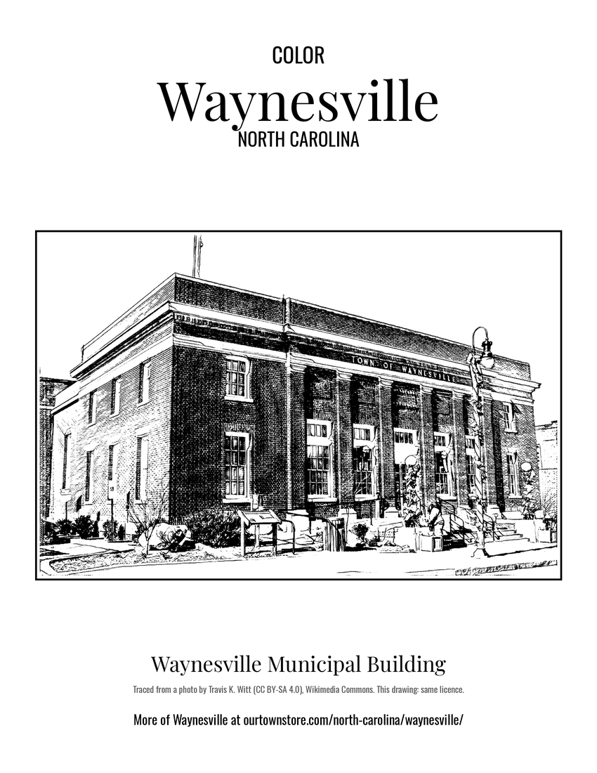
The Boone-Withers House, Citizens Bank and Trust Company Building, Former, Francis Grist Mill, Frog Level Historic District, Haywood County Courthouse, Alden and Thomasene Howell House, Masonic Hall, Charles and Annie Quinlan House, Clyde H. Ray Sr. House, Frank Smathers House, Spread Out Historic District, Waynesville Municipal Building, Dr. J. Howell Way House, and Waynesville Main Street Historic District are listed on the National Register of Historic Places.

Waynesville was incorporated as a town in 1871. In July 1995, the towns of Hazelwood and Waynesville merged into one community and continued to grow with a population today of over 10,000.

Read the full history

The "Battle" of Waynesville

Waynesville was the scene of the last and perhaps most unusual skirmish in the eastern theater of the American Civil War. On May 6, 1865, Union Colonel William C. Bartlett's 2nd North Carolina (Federal) Mounted Infantry were attacked at White Sulphur Springs (east of Waynesville) by a detachment of rebels from Thomas' Legion of Highlanders.

East of the Mississippi, Thomas' Legion fired "The Last Shot" of the Civil War in White Sulphur Springs, North Carolina. The Legion consisted of Cherokee and White soldiers. Some of these soldiers had served under Jubal A. Early during the Shenandoah Valley Campaigns of 1864, but had been sent back to their native North Carolina mountains to engage in guerrilla warfare against the remaining Union forces.

The disoriented Union soldiers retreated into Waynesville, and on the evening of May 6 remaining elements of Thomas' Legion surrounded the town. The soldiers lit numerous bonfires on the ridges above the town and engaged in war chants in an effort to intimidate the Federals. The following day the Confederate commanders Gen. James Green Martin and Col. William Holland Thomas (for whom the Legion was named) negotiated a surrender. These commanders had been made aware that Generals Robert E. Lee and Joseph E. Johnston had already surrendered and that continued hostilities would prove pointless.

Frog Level

Waynesville began to see development after arrival of the railroad in 1884. The agricultural, lumber and tourism industries in Waynesville and Haywood County began to thrive as access to the west was opened up.

The area of Waynesville located along Richland Creek, northwest and downhill from Main Street, was where the railroad tracks were laid. Until this time the area had been essentially a swampland, with a few scattered buildings but no major development. Once the depot was built and the train arrived this section was developed. It was given the name of "Frog Level" by the local community because of its low-lying location along Richland Creek, the "frog level" when the area flooded.

Downtown and the nearby Frog Level commercial centers of Waynesville continued to be the central focus for social life, transportation, and wholesale and retail businesses through the 1940s. Businesses in the Frog Level area in the 1930s and 1940s included hardware stores, farm supplies, coal sales, auto dealers and garages, furniture stores, wholesale groceries, and warehouses and lumber companies, all of which were businesses dependent on the railroad.

As the automobile became the primary mode of transportation for most residents, the railroad declined in importance. This in turn led to a shift of business away from Frog Level. The last passenger train arrived in Waynesville in 1949, and freight trains pass through Frog Level twice daily, with most trains continuing on to Sylva.

By the 1980s, the railroad in Waynesville had been integrated into the Southern Railway Company system. The first depot burned in 1900, but it was soon replaced with another depot that remained standing until 1987.

Adapted (trimmed) from the Wikipedia article Waynesville, North Carolina, revision 1378268558 by its contributors, licensed CC BY-SA 4.0.

For local organizations

Are you with a Waynesville historical society?

We share a part of every Waynesville sale with local partners, and we'd love to print from your collection. Old photographs, maps and postcards make the best keepsakes.

Partner with us
Custom orders

Want something Waynesville we don't make yet?

A favorite landmark, your street, a school or team, an anniversary gift, a different product. Tell us and we'll get back to you by email.

Free printables

Color Waynesville

15 free coloring pages of Waynesville, each traced from a photo of a local landmark. Print them at home, at school or for story hour.

Nearby

Neighboring towns

Sources

Waynesville's population was 10,140 in the 2020 U.S. Census, up from 9,869 in 2010.