A short history of Council Bluffs
1804–1843: Pottawattamie reservation and Caldwell's Camp
The first Council Bluff (which is singular) was on the Nebraska side of the river at Fort Atkinson, about 20 miles (32 km) northwest of the city of Council Bluffs. It was named by Lewis and Clark for a bluff where they met the Otoe people on August 2, 1804.
The Iowa side of the river became an Indian Reservation in the 1830s for members of the Council of Three Fires of Chippewa, Ottawa, and Potawatomi who were forced to leave the Chicago area under the Treaty of Chicago. This cleared the way for the city of Chicago to incorporate.
The largest group of Native Americans who moved to the area were the Pottawatomi, who were led by their chief Sauganash ("one who speaks English"), the son of British loyalist William Caldwell and a Mohawk woman. The senior Caldwell founded Canadian communities on the south side of the Detroit River.
Seeking to avoid confrontation with the Sioux, who were natives of the Council Bluffs area, the 1,000 to 2,000 Pottawattamie initially had settled east of the Missouri River in Indian territory between Leavenworth, Kansas and St. Joseph, Missouri. When the area was bought from Ioway, Sac and Fox tribes in the Platte Purchase and part of Missouri in 1837, Sauganash and the Pottawatomi were forced to move to their assigned reservation in Council Bluffs.
Sauganash's English name was Billy Caldwell, and his village was called Caldwell's Camp. The tribe were sometimes called the Bluff Indians. U.S. Army dragoons built a small fort nearby.
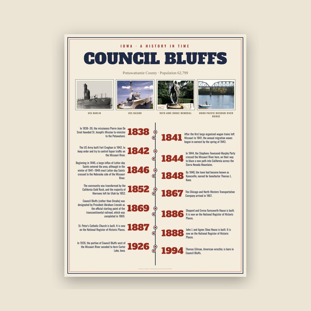
In 1838–39, the missionary Pierre-Jean De Smet founded St. Joseph's Mission to minister to the Potawatomi. De Smet was appalled by the violence and brutality caused by the whiskey trade and tried to protect the tribe from unscrupulous traders. However, he had little success in persuading tribal members to convert to Christianity and resorted to secret baptisms of Indian children.
During this time, De Smet contributed to Joseph Nicollet's work in mapping the upper Midwest. De Smet produced the first European-recorded, detailed map of the Council Bluffs area; it detailed the Missouri River valley system, from below the Platte River to the Big Sioux River.
Imagine a great number of cabins and tents, made of the bark of trees, buffalo skins, coarse cloth, rushes and sods, all of a mournful and funereal aspect, of all sizes and shapes, some supported by one pole, others having six, and with the covering stretched in all the different styles imaginable, and all scattered here and there in the greatest confusion, and you will have an Indian village.
As more Native Americans were pushed into the Council Bluffs area by pressure of European-American settlement to the east, intertribal conflict increased, fueled by the illegal whiskey trade. The US Army built Fort Croghan in 1842, to keep order and try to control liquor traffic on the Missouri River. However, the fort was destroyed in a flood later in the same year.
Read the full history
1844–1851: Mormon community of Kanesville
In 1844, the Stephens-Townsend-Murphy Party crossed the Missouri River here, on their way to blaze a new path into California across the Sierra Nevada Mountains. Beginning in 1846, a large influx of Latter-day Saints entered the area, although in the winter of 1847–1848 most Latter-day Saints crossed to the Nebraska side of the Missouri River. Initially, the area was called "Miller's Hollow", after Henry W. Miller; a settler, he was the first member of the Iowa State Legislature to be from this area. Miller also was the foreman for the construction of the Kanesville Tabernacle.
By 1848, the town had become known as Kanesville, named for benefactor Thomas L. Kane. He had helped negotiate federal permission in Washington, D.C. for the Mormons to use Indian land along the Missouri as their winter encampment of 1846–47. Built next to or at Caldwell's Camp, Kanesville became the main outfitting point for the Mormon Exodus to Utah; it is the recognized head of the Mormon Trail.
Edwin Carter, who would become a noted naturalist in Colorado, worked here from 1848 to 1859 in a dry goods store. He helped supply Mormon wagon trains.
Settlers who departed west from Kanesville into the sparsely settled, unorganized parts of the Territory of Missouri traveled to the Oregon Country and the newly conquered California Territory. They traversed the (eventual) Nebraska Territory traveling in wagon trains along the much-storied Oregon, Mormon, or California Trails into the newly expanded United States western lands.
After the first large organized wagon trains left Missouri in 1841, the annual migration waves began in earnest by the spring of 1843. They built up thereafter, with the opening of the Mormon Trail (1846) and peaked in the later 1860s. After that, news of the progress of railroads constructed across the west reduced the number of travelers who endured the wagon trains.
By the 1860s, virtually all migration wagon trains passed near the town now named Council Bluffs. The wagon train trails became less important with the advent of the first complete transcontinental railway in 1869, but while trail use diminished after that, their use continued on at lesser rates until late in the nineteenth century.
The Mormon Battalion began its march from Kanesville to California during the Mexican–American War, which began This area was where Mormons first began to openly practice plural marriage. Orson Hyde began to publish The Frontier Guardian newspaper, and Brigham Young was named as the second president of the Church of Jesus Christ of Latter-day Saints (LDS church). The community was transformed by the California Gold Rush, and the majority of Mormons left for Utah by 1852.
1852–1900: Beginning of the railroad era
By 1852, the number of Mormons was declining due to their further westward movement. The town took the name Council Bluffs after a cliff called Council Bluff that was 20 miles to the north. Fort Atkinson was built there in 1820. That cliff, or bluff, was named after the so-called Otoe council. This was an August 1804 meeting of the Lewis and Clark Expedition with senior members of the Otoe and Missouria Native American tribes.
At Council Bluffs our arrival was greeted by a few rounds from the old six pounder, while the streets were lined with a curiosity-seeking class of humanity, among which could easily be traced the physiognomy of bipeds of almost every clime—all here to make money. The cute Yankee whittling out wooden hams to sell to Pikes' Peak emigrants, the Chatham Street peddler, with his stock of "oht clo's," ready to swear that he had them manufactured expressly for his western trade; the mock auctioneer, the jeweler with his pinchback jewelry of all kinds; horse and mule jockeys, gamblers, thieves, assassin—and the mischief knows what not, rather than what is—all congregated in this little 7×9 city, stuck in a great ravine, 3 miles from the Missouri River. When you understand that this is the great entrepot for emigration across the Plains, you will readily comprehend that this is a good point at which to "take (a) stranger in," and it is done almost every day. Our stay at Council Bluffs was very short (two days) and I think no one was sorry to leave it.
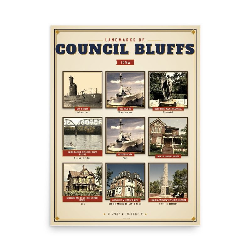
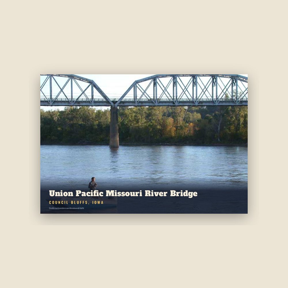
Council Bluffs (rather than Omaha) was designated by President Abraham Lincoln as the official starting point of the transcontinental railroad, which was completed in 1869. The official "Mile 0" start is at 21st Street and 9th Avenue. It is now marked by a gold spike monument, which was erected to promote the movie Union Pacific. Council Bluffs' physical connection to the Transcontinental Railroad was delayed until 1872, when the Union Pacific Missouri River Bridge opened. (Before that, railroad cars had to be ferried across the Missouri River from Council Bluffs to Omaha in the early days of the Transcontinental).
The Chicago and North Western Transportation Company arrived in 1867. Other railroads operating in the city were the Chicago, Rock Island and Pacific Railroad, Chicago Great Western Railway, Wabash Railroad, Illinois Central Railroad, and the Chicago, Burlington and Quincy Railroad as well as the Chicago, Milwaukee, St. Paul and Pacific Railroad.
1901–present
In 1926, the portion of Council Bluffs west of the Missouri River seceded to form Carter Lake, Iowa. Carter Lake had been cut off by a change in the course of the Missouri River.
By the 1930s, Council Bluffs had grown into the country's fifth largest rail center. The railroads helped the city become a center for grain storage, and in grain elevators continue to mark the city's skyline. Other industries in the city included Blue Star Foods, Dwarfies Cereal, Frito-Lay, Georgie Porgie Cereal, Giant Manufacturing, Kimball Elevators, Mona Motor Oil, Monarch, Reliance Batteries, Woodward's Candy, and World Radio. During the 1940s Meyer Lansky operated a greyhound racing track in Council Bluffs.
Restructuring of the railroad industry caused the loss of many jobs after the mid-20th century, as did the restructuring of heavy industry. Many jobs moved offshore. By the late 20th century, the city and region were suffering economic stagnation and a declining population, as they struggled to develop a new economy. Downtown urban renewal was undertaken to create a new future while emphasizing the strengths of heritage.
Council Bluffs was prominently featured on an episode of Bar Rescue, when Jon Taffer visited the O'Face Bar. This would also be the first ever instance of Taffer walking out on a bar in the series.
Adapted (trimmed) from the Wikipedia article Council Bluffs, Iowa, revision 1384992524 by its contributors, licensed CC BY-SA 4.0.